
library(sf)
library(spData)
world_mollweide = st_transform(world, crs = "+proj=moll")
plot(world_mollweide["lifeExp"], graticule = TRUE, main = "Life Expectancy")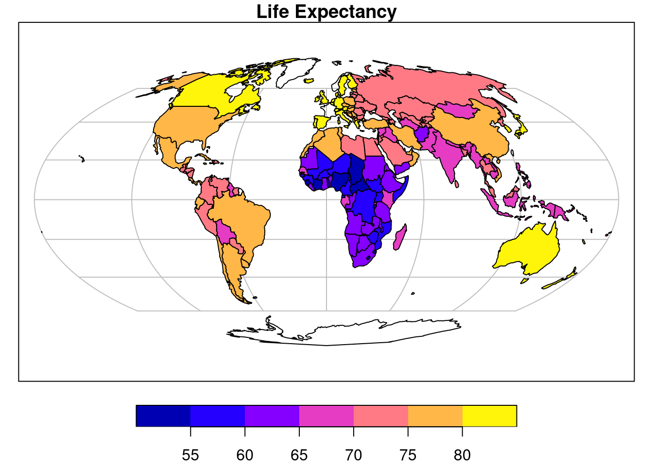
Hello everybody! A lot of things have changed since the last blogpost about Geocomputation with R. In this post I’ll give an update of our progress and our plans for the next chapters.
A huge amount of effort has gone into creating the Foundations part of the book (Chapters 1 to 6) . These chapters contain tons of useful information about, among other things, vector and raster data structures, spatial data import and export and attribute, spatial, and geometric operations. The latter also gives an overview of one of the corner stones of geocomputation - coordinate reference systems (CRSs), explaining how to make maps like the global map of life expectancy generated by this code:
library(sf)
library(spData)
world_mollweide = st_transform(world, crs = "+proj=moll")
plot(world_mollweide["lifeExp"], graticule = TRUE, main = "Life Expectancy")
The second part of the book focuses on basic applications with examples of transport and location analysis.
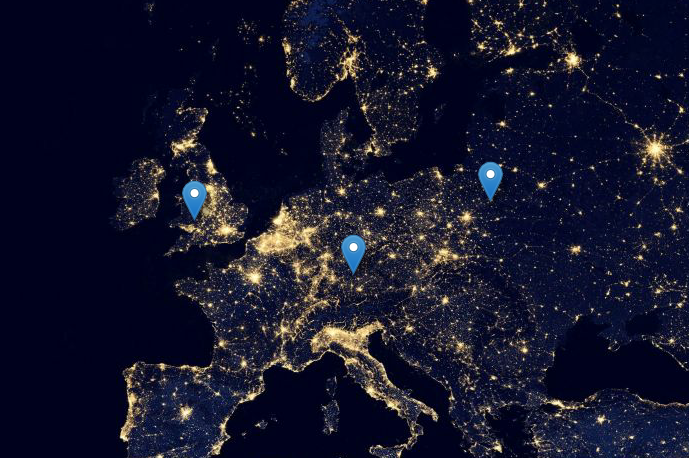
The transport chapter gives an overview of geographic analysis of transport systems and shows it in practice using a city of Bristol as an example. What are patterns of transport behavior in the city? What can be changed? Where the new improvements could be located?
![]()
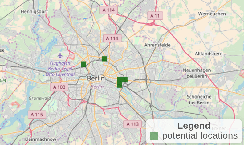
The location chapter shows how to find optimal locations for selected services. The corresponding case study explores where to establish bike stores in metropolitan areas of Germany for a specific target customer group while using freely available census data.
Both chapters apply command-line based geocomputation introduced in chapters 1-6 to the real world, and answer relevant questions in a reproducible manner with the help of open data and R.
The next part of the book will be about more advanced geocomputational methods. It includes interactions between vector and raster data and spatial visualizations. While, we have a lot of ideas for the next chapters, we are also open to any suggestions about future content of the book so feel free to contact us on twitter - Jakub and Robin or github - see information below.
We also have the pleasure to be part of GEOSTAT 2018 - a summer school organized by R and Open Source (OS) GIS developers and enthusiasts. This year, lecturers are (in alphabetical order), Veronica Andreo, Tim Appelhans, Roger Bivand, Tomislav Hengl, Hanna Meyer, Markus Neteler, Edzer Pebesma, and Barry Rowlingson. Registration closes on 1 February, so don’t hesitate and join us to learn about various aspects of statistical analysis of spatial and spatio-temporal data using Open Source tools! More information at https://geostat-course.org/2018.
We decided early on to develop this book in the open to remove financial barriers to learning open source software. It also enables community contributions, which we encourage on any part of the book, for example:
A regularly updated online version of the book can be found at https://geocompr.robinlovelace.net/ which can be edited from our github repo or by clicking on the ‘edit’ pencil-shaped symbol at the top left of any part of the book:

@online{nowosad2018,
  author = {Nowosad, Jakub},
  title = {Geocomputation with {R} - the Intermission},
  date = {2018-01-25},
  url = {https://jakubnowosad.com/posts/2018-01-20-geocomputation-with-r-the-intermission/},
  langid = {en}
}