
Blog posts in the series introducing GeoPAT 2 - a software for pattern-based spatial and temporal analysis:
- GeoPAT 2: Software for Pattern-Based Spatial and Temporal Analysis
- Pattern-based Spatial Analysis - core ideas
- Finding similar local landscapes
- Quantifying temporal change of landscape pattern
- Pattern-based regionalization
- Moving beyond pattern-based analysis: Additional applications of GeoPAT 2
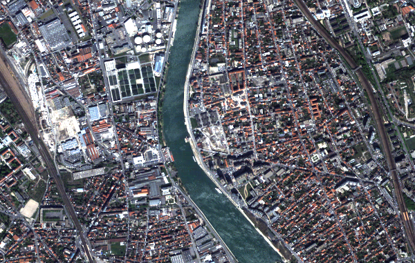
Take a look at the satellite image below - do you see buildings? Roads? A river? Are you able to draw a line separating a building and a road? It is a rather easy, but time-consuming, task for a person. Gladly, there is a whole discipline GEOBIA (Geographic Object-Based Image Analysis), focused on extracting meaningful objects from remote sensing imagery.
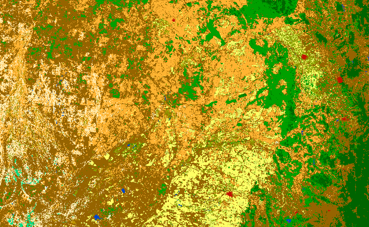
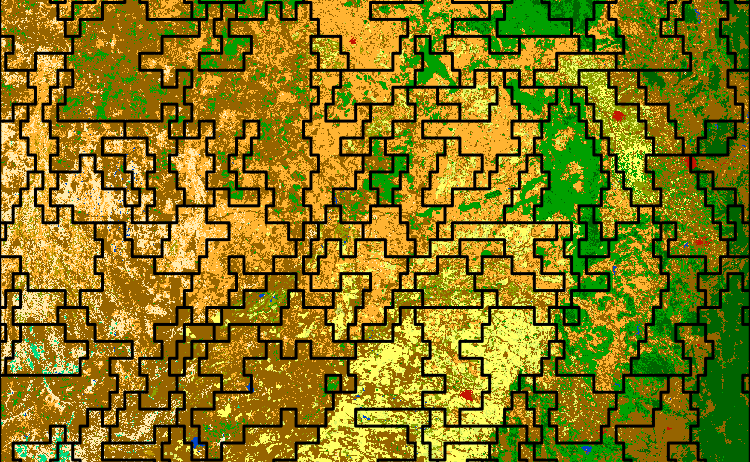
Now, try to do the same with the image below representing a land cover over a part of Eastern Australia. Do you see any objects? If not, are you able to identify different types of patterns? Can you partition this image into meaningful, consistent groups of patterns? How about distinguishing spatial patterns over the data for the entire continent or the whole world?
This is not an easy task for a human eye - not only it is time-consuming, but it is also hardly reproducible. Those are some of the reasons why we developed GeoPAT 2 - an open-source software for pattern-based spatial and temporal analysis. It works on categorical maps (e.g. land cover, geomorphons) and its main focus is on blocks of pixels (and therefore patterns), rather than values of single pixels. This approach makes it possible to asses characteristics of a local pattern (the block of pixels), but also compare its pattern with other “blocks”.
Somebody can ask - is there GeoPAT 1? What is the difference between GeoPAT and GeoPAT 2? The first version of the GeoPAT software was developed for GRASS GIS and its main role was to test the ideas and build the foundations of to the pattern-based spatial analysis. There are several changes between the first and the second version, but the most prominent one is GeoPAT 2 do not require GRASS GIS to be run. It a standalone software, which the only requirement is GDAL. There is also a number of additional changes between the versions, including experimental support for analysis of patterns in time-series spatial data.
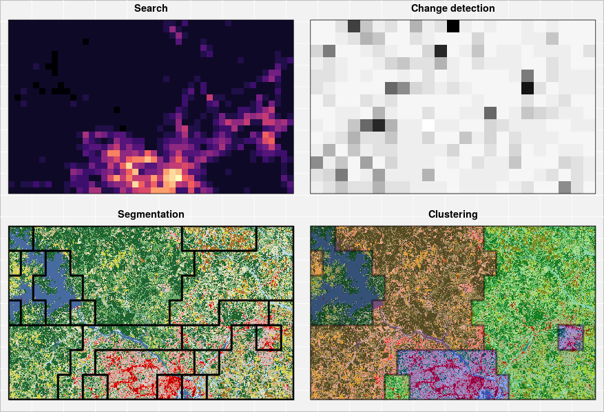
The pattern-based analysis allows for four main types of analysis:
- Search - finding areas similar to a queried local landscape
- Change detection - comparing local pattern between two maps
- Segmentation - partitioning a map into regions of cohesive patterns
- Clustering - grouping patterns that are similar
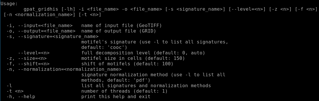
In a series of blog posts, I will explain basic concepts of pattern-based spatial analysis and give practical examples of the GeoPAT 2 use. The next blog post will focus on the core ideas - what is a motifel, spatial signature and similarity metric. In the meantime, you can download the latest version of this software (either as a Windows installer or Linux source code) from our Github webpage. Additional information can be also found in the official GeoPAT 2 manual and presentation Describing landscapes by statistics of local pattern features.
Reuse
Citation
@online{nowosad2018,
  author = {Nowosad, Jakub},
  title = {GeoPAT 2: {Software} for {Pattern-Based} {Spatial} and
    {Temporal} {Analysis}},
  date = {2018-06-18},
  url = {https://jakubnowosad.com/posts/2018-06-18-geopat-2-software-for-pattern-based-spatial-and-temporal-analysis/},
  langid = {en}
}